Sunday, August 31, 2008

Chicken and Eagle, AK


The Top of the World Highway is an all dirt road. I tried to get a picture of at least a couple of the millions of potholes. The Suburban really rides like a truck sometimes.


At the end of the day, we had homemade Blueberry Buckle and ice cream, made and served by the campground hosts. Yummy. The kitchen in the campground was excellent.


Nobody missed out on this goody.


In the summer, the town of Chicken has 21 residents. In the winter, there are 6 residents. The only businesses are 2 campgrounds, the post office, and the "strip mall" of a diner, liquor store (very slim pickings and twice the price), gas pump (no station) and souvenir store. The full time residents aren't too fond of the "newcomers". Cold and rain during our visit here in the dry camp...that was full of puddles and mud.

Leaving the trailers and driving the 90 miles each way to Eagle, part of it on the same Top of the World Highway, we traveled with Betty Ivy while her husband, Mike, stayed back to do some work on something in their trailer. We enjoyed a very s-l-o-w lunch, then toured the museum and restored Fort Egbert. Interesting. During lunch, across the Yukon River, there was a black bear loping along the beach. He decided to cross the river to our side. This is one big river with a fast current...not to mention cold. That poor bear got swept past us and on down the river. The local wildlife management man said if the bear couldn't get to land, he could drown. We all hoped he made it....

The reason I'm writing this is.... it's one of the few days that Elaine forgot her camera. Can you believe it? Sigh.

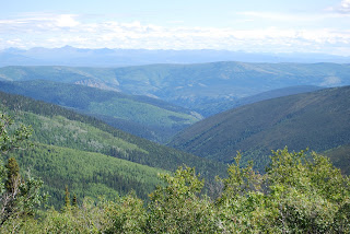
We got back into the cars and headed back to Chicken on that muddy and pot-holed road. It was only 4 1/2 hours one way. Yeah. 90 miles. That's a clue about the road. But the scenery was spectacular...and baren.

Monday, August 25, 2008

Time to ferry across the Yukon River

The journey across the Yukon River, for 35 trailers/RV's was about 5 hours. Yes, you read that right. No more that 3 at a time, depending on the length of the vehicle.


We weren't even last...


Finally..soon it will be our turn.


Here we go..


Off we go...


Top of the World Highway..a golf course??


ahhhhh


WOW!!


US/Canada Border


Does this road ever end???

Sunday, August 24, 2008

Preparing for the Top of the World Highway

The highway is gravel. Apparently there are cases of broken windows from flying stones from oncoming traffic and bugs clogging up the radiator. Three people in the caravan have had cracked windshields. These are Rick's solutions.


Bubble-wrap and duct tape on the side windows of the Airstream.


This is a contraption we picked up in Prince George at the campground that was free and someone else had used. It's held on with bungies. When we return to the same campground at the end of the Caravan, we will leave it for someone else to use. There were maybe a dozen different ones piled there.


Rick cut this screening and duct taped the edges, then used plastic ties to attach it. This is for bugs and stones hitting the radiator.


Just had to take a picture of this bus that someone is living in...hard to believe. It's in the middle of the gravel piles.

Saturday, August 23, 2008

Dredge Number Four

What is a Dredge? It is a huge machine that digs up the creeks to find the gold in them. This is the last one to operate in Dawson City, actually until the 1950's, when it sank to the bottom of the lake. Lake? Creek? They dammed up the creeks and these dredges floated on the lakes that were created. Large companies came in after the gold was actually discovered via an individual man and his pan.


These piles of stone were created by the dredge "spitting out" the unwanted stones. If you go back to the gold mine picture in the last page of the blog, and enlarge it, you will see the worm-like things at the bottom of the picture. It's these piles of rejected stones. They are everywhere.


Sometimes there are ponds created by the stones. There's no soil, so not many plants.


These next 2 pictures kind of describe how the dredge works. Digs it up. Drops it on the sluices, and then out the unwanted stones go on the conveyor on the back.


These are the buckets, still buried in the mud from when it sank in the 1950's. It remained untouched and buried for 30 or so years until they decided to restore it as a museum.


Some of the gears.


The gravel was put on this, the large stones ended up on the conveyor and discarded.


Everything else went down the sluices. The gold is much heavier than the stones (about 20 times heavier) and was trapped in the sluices. They had material (like burlap...today they use artificial turf) to catch the small flakes of gold, and hopefully lots of nuggets.


More gears.


Handles to operate all the gears.


Front of the dredge.


Rear of the dredge where the discarded stone came off the conveyor. Now you know all about gold mining. Don't forget to add in the permafrost...all the gravel was frozen...no gold unless you could thaw it (even in the summer), or the -20 to -60 degree winters with many feet of snow.

The Dome

This is the view from the top of one of the mountains above the town. Drove the dirt road to the top. We were alone to view these fabulous scenes. Later we heard that a grizzly and 2 babies had been seen on the road earlier in the day. Don't forget to click on these pictures...they're really great when they are enlarged.


Yukon River and most of the town of Dawson City.


View downriver.


The gold mine that is still in operation. See the road that is on the right and goes up the valley? That's the road to Dredge #4.


Can you see the layers of mountains in the distance? See the little road that goes up and winds around the moutain? That's how we left town...the beginning of the Top of the World Highway. You can see it on the second mountain, and again at the top of the mountain on the right....way far away. That's where we went!


A pretty, unusual flower at the top of the mountain.

Thursday, August 21, 2008

Robert Service and Jack London

They both lived in Dawson City in these cabins. This North country had profound effects on both of their lives.


Robert Service's cabin.


Rick looking in the back door.


These roofs were good insulators.


These steps were soft to walk on. Weird.


We went to a program about Robert Service. This fellow told of his life and read several of his poems.


Jack London's cabin and cache (elevated room to store meat and food so bears couldn't get it.) is open to the public, also.

Sternwheeler Keno

One of the last sternwheelers to work the Yukon River. Now they give tours of it.


There was so much wood needed for the opening of the land, mostly due to the gold rush, the forests still haven't recovered. This one boat on one trip used something like 40 cords of wood just to go one way and it's one of the smaller ones. There were dozens of boats, buildings being built, heat for the long cold winters, they were cutting further and further from the rivers.


The store across the street....they spell different up here...


Rick at the wheel. (This wasn't even on the boat.)


The engine room.

New and Old Dawson City, YT

It is a town of contrasts. The "new" is very colorful...and not very new. The old is what happened when building improperly on the permafrost. There are no basements in Alaska due to permafrost. All buildings are sitting on a special gravel to protect the permafrost. It's like an underground glacier. It's anywhere from several inches to several feet below the surface. Dawson City has no paved roads..all dirt with potholes. All roads are specially prepared with a base of extra gravel before paving to protect the permafrost. With the supercold winters up here, (-20 to -60 all winter) most of the roads have heaves and potholes. Our truck rides like...a truck!


There are moose or caribou or elk antlers on many, many of the buildings.